 LayerArc
Order Now →
LayerArc
Order Now →
A journey
that lives on.
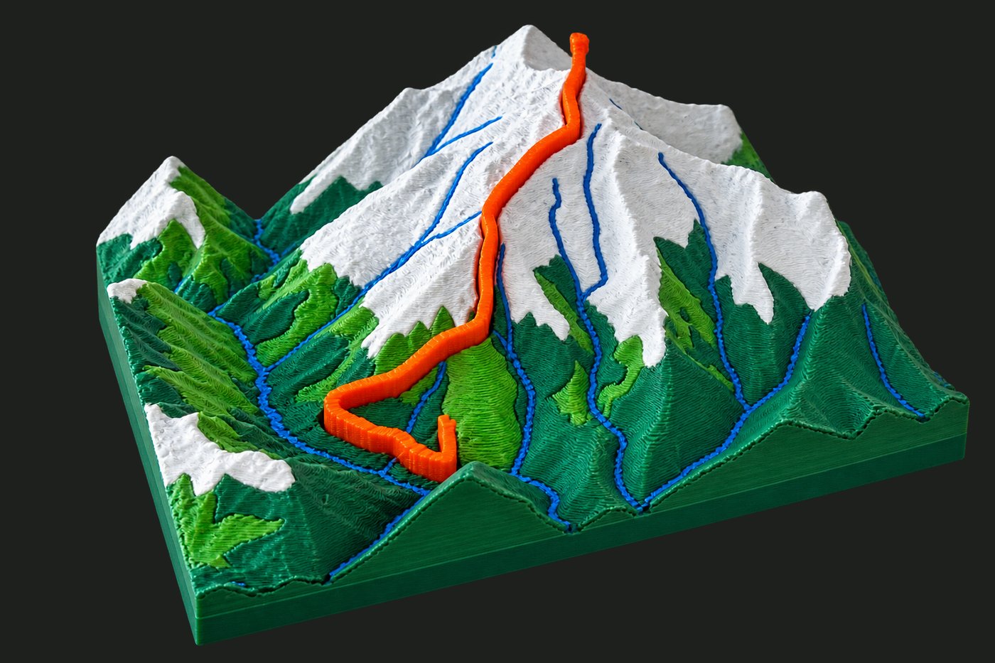
We take your GPS route — any Himalayan peak or custom trail — and 3D print it with real satellite terrain, your path inlaid in terracotta, and your name engraved on the frame.
Build My Mountain →elevation data
included free
all of India
Three steps.
One keepsake.
Customize your model
Pick size (60–100 mm), frame shape, texture finish, and base color. Add your name, elevation, and date to the four engraved edges.
Try the configurator →Pick your mountain
Choose from 25+ surveyed Himalayan peaks — or send us your GPX file, Strava route, or any mountain on Earth.
Browse all peaks →We make & ship it
Order in 60 seconds on WhatsApp — no upfront payment. We 3D print, frame, and engrave it, then ship — delivered in 5–8 business days across India.
Start your order →See it.
Spin it.
Feel it.
Toggle size, texture, and color — the model updates live in your browser. This is the exact geometry we send to the printer.
Drag to orbit · Scroll to zoom
Popular peaks
Real trails.
Real trekkers.
Every single review from our customers — unedited.
Every size.
Frame included.
No hidden costs. Shadow frame with 4-side engraving is included in every price below.
Quick answers.
What sizes are available and what's the price?
Small (60 mm / ₹699), Medium (80 mm / ₹1,149 — most ordered), and Large (100 mm / ₹1,699). Every model includes a shadow frame with 4-side custom engraving.
Can I order my own custom route or unlisted mountain?
Yes — any trail on Earth. Send us your GPX file, Strava activity link, or just the mountain name on WhatsApp and we'll build it. The price is the same.
What exactly gets engraved on the frame?
Four sides, four lines — you choose each one. Typically: top (your name), bottom (trek name), left (elevation), right (date). You can put anything you like. It's laser engraved permanently into the frame.
How does ordering actually work?
Fill in the order form in 60 seconds, then send it to us on WhatsApp or Instagram. We share a 3D preview for your approval, confirm the details, and take payment via UPI or bank transfer. Production takes 2–3 business days, plus 3–5 days shipping — delivered in 5–8 business days across India.
What is Multi Color, and who is it for?
Multi Color (₹2,699, 100 mm only) uses green for valleys, brown for rocky mid-slopes, and white for snow-capped peaks — full topographic color. Everything else is Glacier White or Stone White with a terracotta route inlay.